
The Isle of Thanet lies at the most easterly point of Kent. We visited its main towns; Margate, Broadstairs and Ramsgate.
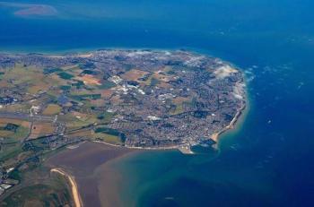
It is no longer an island, but it was up to 1672 when it was separated from the mainland by the 600-metre Wantsum Channel. The Wantsum Channel allowed ships to sail between the mainland and the island in calm waters , but gradually this silted up over time.
The Wantsum area is still liable to flooding: during the North Sea flood of 1953 Thanet was cut off for a few days, but the sea defences have been strengthened since then.
In 43 AD, Roman Emperor Claudius sent four legions to Britain, where the Romans were to remain for the next 367 years. During that time the port of Richborough, on the opposite side of the Wantsum Channel, became one of the chief ports and one of the landing areas for the Roman invasion.
Commonly the original meaning of ‘Thanet’ is thought to be ‘fire/bright’ island which led to speculation the island was home to an ancient beacon or lighthouse.
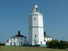
The name might have come from the predecessor to the current North Foreland lighthouse which sits on the eastern end of the Isle of Thanet and commands views over the southern North Sea.
The current lighthouse (the last manned lighthouse in the UK before automation in 1998) dates back to 1691. Currently, the cottages around the lighthouse can be rented as holiday accommodation.

Leave a comment