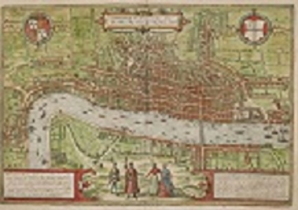
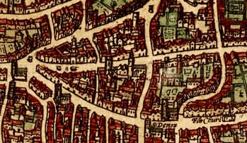
In 1572, cartographers Georg Braun from Germany and Frans Hogenberg from Belgium produced an early birds-eye detailed map of London. Most people lived inside the city walls, with the areas outside being the surrounding counties of Middlesex, Essex, Kent and Surrey. The map is very accurate showing lots of detail.
At the time, the population of London was roughly 200,000, but with this concentration of people, the city was susceptible to outbreaks of disease and particularly the Plague.
London was navigable chiefly by the River Thames, which brought much of the trade which made the city wealthy. Travelling by road was very dangerous, with a high threat of being robbed, so any traders by road travelled in convoy by horse and cart. There was only one bridge across the Thames; London Bridge, which included various buildings and shops across its length, as well as being simply a thoroughfare. Most people walked across the bridge, but if you were wealthy, you could be rowed across for about 5p.

At the bottom of the map, the illustrations of the people who could easily be actors, give an indication of the theatres that were about to takeover the Southbank and Shoreditch, giving opportunities to new writers like William Shakespeare.

Leave a comment